Underground Railroad Map
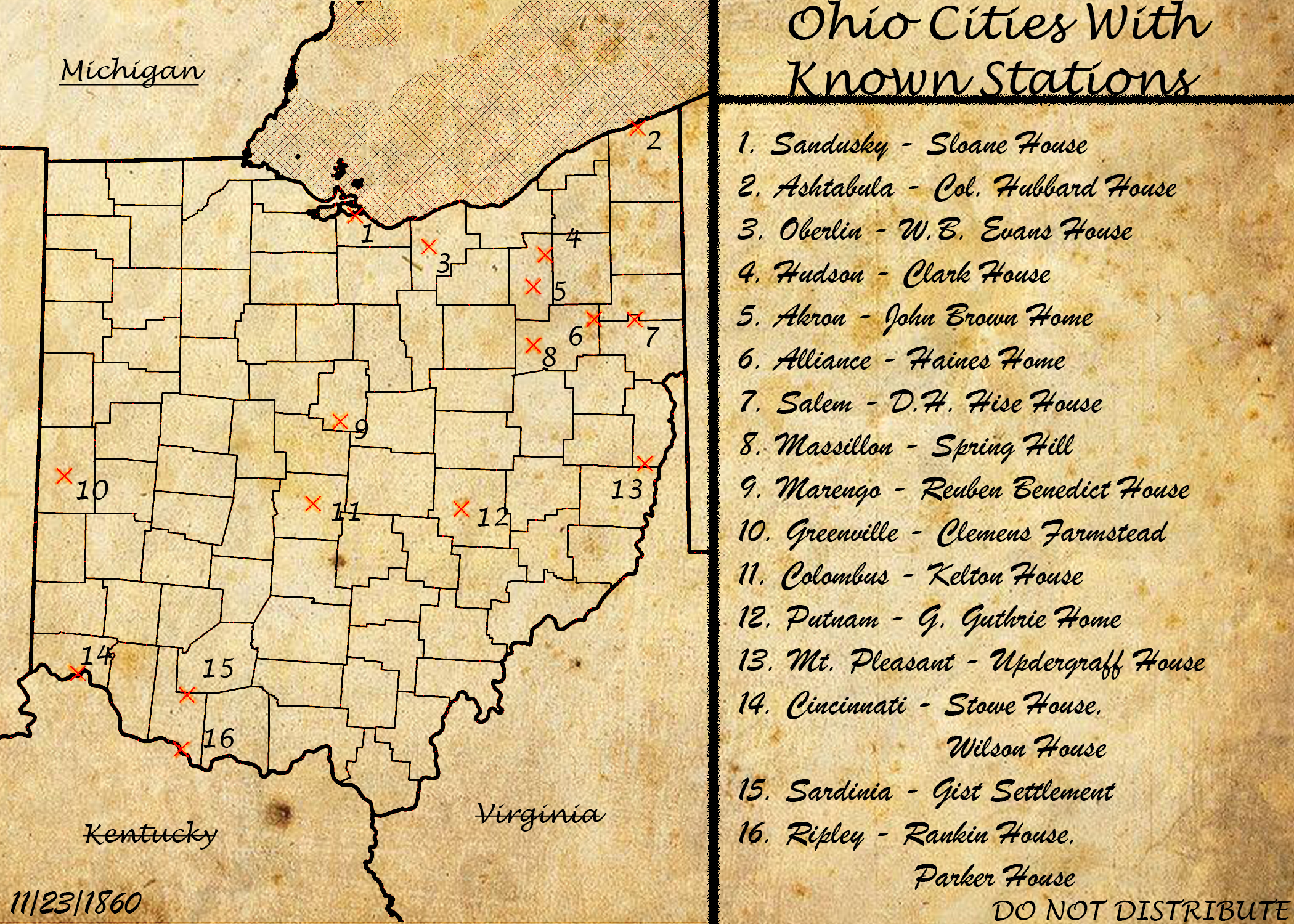
This map represents a level of cartographic accuracy that cartographers of the time could only dream of. However, this is a representation of what a map of the time may look like. This map depicts 18 stations across 16 cities that span the entirety of Ohio. Much like how the operators at the time wouldn't know of every single station in a location, this map too works off of what our group found and researched. While southwest Ohio, central Ohio, and northeast Ohio, seem to have held the majority of stations in this document, that may not necessarily be the truth of the situation. However, any operator of the time would be working with limited and always changing knowledge, so this may very well be an accurate depiction of what an agent knows to be true. Furthermore, on this map, we see that the date places this document before the civil war, and that this document should be held with secrecy; if this document were to find its way into the hands of a bounty hunter then that could mean trouble for the railroad.
Shawn Lane